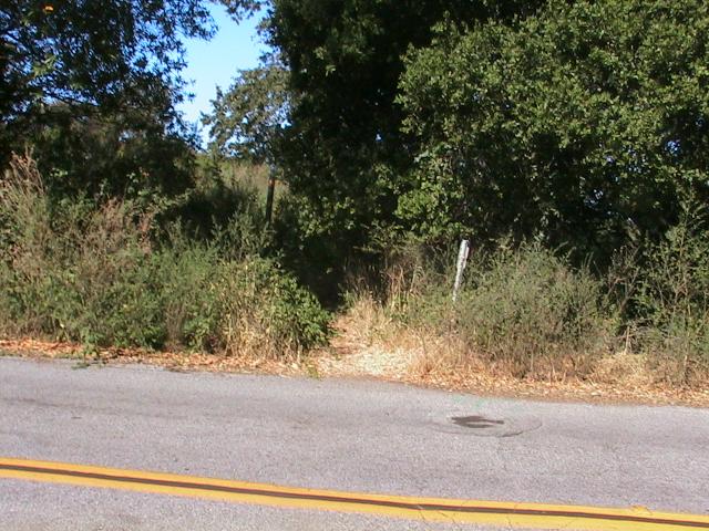
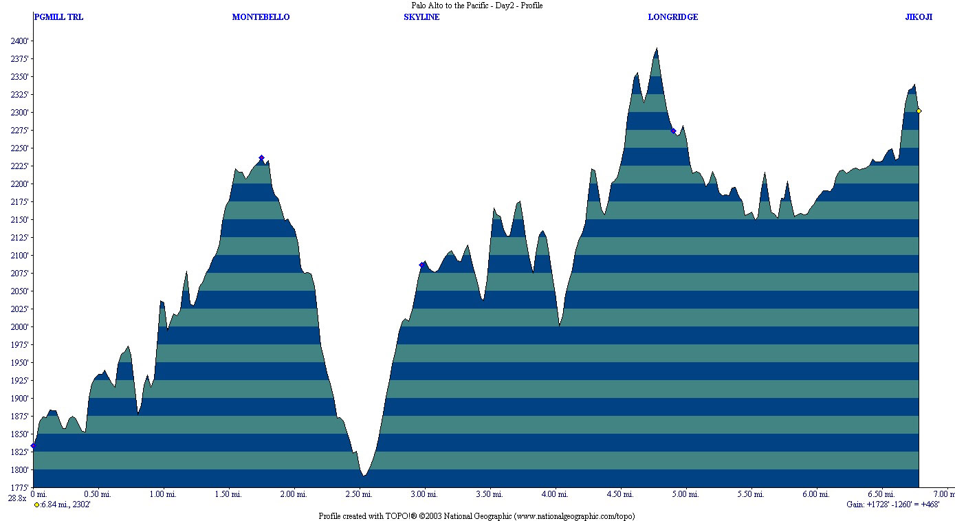
 This was the last day of Labor Day weekend, and I was determined to make some progress on my thru-hike. Cindy dropped me off where I had finished the previous time, and I started searching for Page Mill Trail. I went up and down the street looking for the trailhead, and then started inspecting private driveways to see if I could find where the trail started. Finally, I saw what looked like a trail sign in the distance, and made my way to it. Sure enough, it was the trail I was seeking, and I traced it back to the entrance. This trail entrance is nothing more than a three-foot wide cut in some bushes, and is the most unremarkable entrance to an open space district I can imagine (see the picture on the left). They've done a good job of hiding it. I suppose there is a purpose, to keep traffic down as there is no public parking nearby. Nevertheless, this entryway does no justice to Los Trancos property.
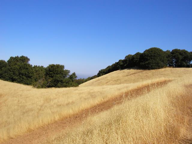 I started down the trail and was soon in a sea of sun-bleached grass and open space. The views from this hill were spectacular. But I had to keep moving because there was no shelter on this trail and the sun was climbing towards its mid-day position where it would bake me through and through.
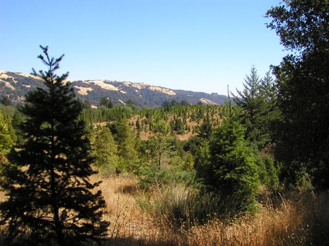
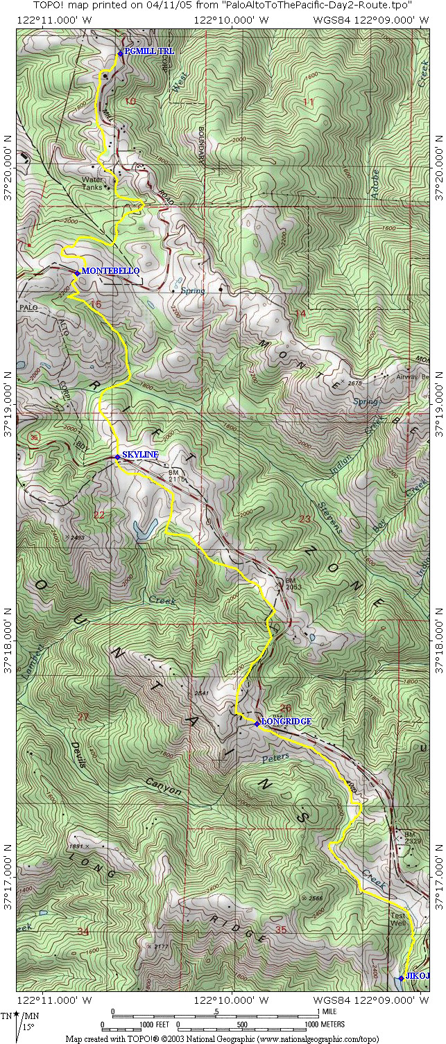
 After a continuous climb I crossed Page Mill Road again and entered the Monte Bello Open Space District. I was hoping for some water at the entrance, but it was dry. Monte Bello has beautiful rolling hills and scenic vistas. The trail went down a valley and along a shaded creek, so there was some relief from the sun and the heat. Eventually I crossed Stevens Creek, which actually had some water in it, and met a hiker who offered me an excellent map of the nearby Open Space Districts. After a short climb I came to the crossing at Highway 35, which marks the transition to Skyline Ridge. I remember standing in the middle of Highway 35 trying to take a photo of the scenery and almost getting hit by an oncoming car.
 Skyline Ridge struck me as a mountain bike heaven. They were everywhere. I found a nicely shaded bench on the edge of Horseshoe Lake and had lunch. The cool water and relief from the heat was very refreshing.
 Picking up the trail again, I headed in the direction of Long Ridge, but quickly got confused by a tangle of trails surrounding a Christmas Tree farm. Fortunately, my GPS straightened me out and I made it to the Long Ridge gate. The trail in Long Ridge is well marked and easy to follow. The first stretch was exposed and hot, but later it followed a shady creek and that was pleasant.
 I had intended to exit the Preserve through a gate near some private property, but that turned out to be a road going through the Jikoji Meditation Center and public access was restricted. So I decided to backtrack about one mile and return to a public parking lot servicing Upper Stevens Creek County Park. There I was able to yogi a ride down the hill from a helpful Stanford professor and his wife, and they dropped me off right near home.
This was by far the hottest and driest segment of this hike, and probably would best be done in April or May when the hills are spectacularly green and the streams are flowing. Nevertheless, the golden hills were scenic and vistas fantastic.
Statistics for Day 2: 8.32 miles covered, 468 ft. elevation gain, September 1st, 2003
Resources and Links
- Los Trancos to Long Ridge Map with suggested route
- Los Trancos to Long Ridge Map with actual GPS track
- Los Trancos to Long Ridge Elevation profile
- Los Trancos to Long Ridge GPS Topo! route
- Los Trancos to Long Ridge GPS Route CSV File
- MidPeninsula Regional Open Space District MROSD South Skyline Open Space Map